|

About the MILUTE Project Vital urban areas are crucial to the well-being of contemporary societies. Cities are the hubs of economic activity and of every form of exchange. They are the places where a growing proportion of the population lives, works and entertains itself. Despite progress in electronic communications, cities must be able to rely on the smooth flow of people and goods in space in order to perform their vital functions. Urban transportation networks, therefore, are key factors in the growth and productivity of urban, regional, and national economies. When these networks fail or work inefficiently, economic consequences can be grave. Indeed, traffic congestion in urban areas causes billions of dollars in lost productivity, reduces local quality of life due to smog, and may, in the long run, dampen investment in the region. But congestion is not due solely to the configuration of roads themselves. The spatial layout of activities—where people live, where they work, shop, bring their children to school, or watch a movie—shapes the flow of goods and people on transportation networks. Good linkages between spatial layout of activities (land use) and transportation networks are therefore critical in sustaining the growth and vitality of urban areas. Research on transportation, land use and energy interactions has become even more critical because Canada recently ratified the Kyoto Accord which calls for a significant reduction in Green House Gas (GHG) emissions by 2012. Transport accounts for roughly 35% of Canada’s CO2 emissions and is likely the fastest growing sector in terms of energy consumption. Québec has been a steadfast supporter of the Kyoto Accord, thus making reduction of GHG emissions an important policy objective. In addition, increasing the efficiency of its road network and of its development patterns will enable the province to improve its economic competitiveness and quality of life. The ultimate purpose of our research, which is being conducted in partnership at various Québec universities (as well as universities elsewhere in Canada), is to facilitate the planning and development of prosperous and sustainable urban areas (communities) by exploring the linkages between land use and transportation. We address this task by adopting an urban systems approach where we study interconnected urban sub-systems such as housing, employment, transportation infrastructure, etc. A comprehensive study of urban areas requires a simultaneous analysis of residential and work location dynamics along with the evolution of transportation networks on a metropolitan level. The research brings these sub-systems into a coherent analytical framework, which will help us understand how one urban sub-system influences another, while simultaneously being influenced by other sub-systems. Understanding the interdependencies between land use and transportation in Montréal will enable us to alleviate traffic congestion, urban sprawl, and transportation-related GHG emissions. At the heart of the research are comprehensive computer models that reproduce the complex and dynamic relationships that sustain the development of urban areas. The primary objective of the research is to develop an integrated transportation-land use equity model for the Greater Montréal Area (GMA). MILUTE will capture the behaviour of individual decision-makers, who face a multitude of choices regarding modes, routes, trip destinations and the like. MILUTE will explore the linkages between land use, urban form, and travel behaviour by using Geographic Information Systems (GIS). The research will be conducted in three distinct phases:
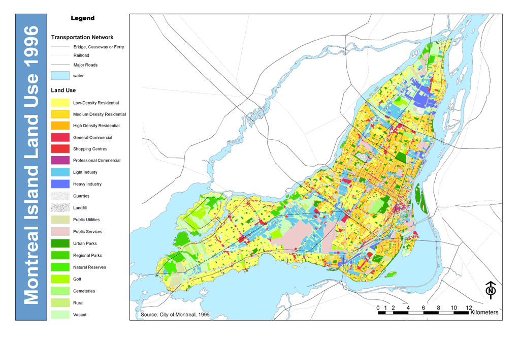
The first phase consist of the design and development of digital databases required for spatial analysis and empirical modelling. The databases include detailed historical records of land use, observed as the spatial distribution of population and employment. In addition, a digital street network is being developed for GMA, with details on number of lanes, road capacity, speed limits, and volume delay functions.
The second phase consist of a spatio-temporal analysis of the dynamics of the constituting urban sub-systems. A statistical profile of urban sub-systems is being developed and the spatial dynamics will be presented as maps and animations. The descriptive analysis of four key factors—the spatial distribution of population, the suburbanisation of work locations, the workings of urban housing and land markets, and the historical development of road and transit networks—will provide the intuitive basis for empirical models.
The third phase consists of the development of the integrated model, MILUTE. Once operational, MILUTE will contribute to public discourse by providing valuable insight into questions regarding urban transportation, land use and their impact on the environment. The integrated model can, for example, simulate the system-wide impacts of construction of a new bridge (e.g., linking Island of Montréal with the South Shore) on accessibility, travel times, reduction in GHG emissions, and housing demand. Similarly, MILUTE could also evaluate impacts of competing alternatives and offer valuable insights to decision-makers. MILUTE will become the backbone of multidisciplinary transportation research at McGill University by bringing together students and faculty from Civil Engineering, Urban Planning, Geography, and Economics. The research is a unique endeavour for Quebec and puts the province, through McGill University, at the forefront of research in integrated land use transportation and equity modelling. The development and subsequent operation and maintenance of the empirical models is being integrated into the curricula of courses taught at McGill University. By participating in the development and operation of integrated models, graduate and undergraduate students will be exposed to the cutting edge in Urban Systems modelling. This work also benefit from the support of the Ministère des Transports du Québec, the Communauté métropolitaine de Montréal, and AMT. These entities have already donated extensive digital databases of land use and travel demand data that are needed for the research. Improved
computer technology is enabling us to confront the growing problem
of road congestion with greater sophistication and realism, at a
time when the problem is growing more severe in terms of economic
and environmental impacts. Research on the interaction between transportation,
land use and the environment is of strategic importance for that
reason, because it can help to increase both economic competitiveness
and urban quality of life. |
|||
©
2005 Murtaza Haider, McGill University |
|||